the feed
Did You Know You Can Fly Fish in Arizona? The 7 Best Places
Here are the 7 best spots for fly fishing in Arizona: Lee's Ferry, Salt river, Silver Creek, Oak Creek Canyon and more. With Maps!
The southwest region of the United States is rapidly gaining popularity for relocation, attracting people from around the world with its appealing weather, job opportunities, and a plethora of outdoor activities. While many know the fantastic opportunities for mountain biking, hiking, climbing, and skiing (yes, we have skiing in the desert!), the quality fisheries often go unnoticed. Whether you're in search of bass in expansive lakes or keen on hiking through backcountry streams for trout, the fishing in the southwest should not be underestimated.
When it comes to the best fishing in the southwest, Arizona deserves to be at the top of the list. With its mountain streams and vast freshwater lakes, the state offers a variety of angling experiences that will satisfy the desires of many anglers. Here is a list of the 7 best places for fly fishing in Arizona, complete with maps for easy navigation:
LEE’S FERRY AREA OF THE COLORADO RIVER
Situated on the Colorado River near Page in Northern Arizona, Lee’s Ferry is an unsurprising top choice for those familiar with the state. This tailwater fishery stretches over 15 miles downstream from Lake Powell to the northern Grand Canyon. The proximity to the canyon, along with consistently clear and cool water at around 50 degrees F, makes it an excellent destination. The stunning red sandstone cliffs accompany anglers as they seek out wild rainbow trout. This intriguing river offers a diverse range of features such as riffles, gravel bars, and deep pools, making it a dream come true for fly anglers.
The fishing remains active year-round, with summer being the busiest due to the cool water. During late fall and winter, rainbow trout engage in spawning activities, providing an opportunity for sight fishing. However, fishing can be challenging in spring due to the snow melt around Lake Powell. For the best access to the Colorado River in Arizona, head to Lee’s Ferry, especially during the offseason to avoid crowds.
When it comes to fly gear, nymphs are highly effective, particularly midge flies in cream or red colors that imitate larvae, pupae, and adults. While occasional mayflies, stoneflies, and caddis flies can be found, sticking to midges in sizes 14-20 generally yields good results. A 5 or 6-weight rod is recommended for this river, along with a 7 to 9-foot leader for nymphing, including an indicator.
SALT RIVER ARIZONA – RAINBOW TROUT HAVEN
Merely 25 miles from Phoenix, the Salt River offers a convenient fishing spot for those on winter holidays. This tailwater flows below the Saguaro Lake and provides cold water sourced from the lake's depths. While most of the river supports rainbow trout, it's primarily a stocked stream with some holdovers. The fishing conditions can be tough during dry years with lower flows, but when the watershed receives sufficient rain, it becomes highly productive.
Trout fishing in the desert might not be the first thing that comes to mind, but the Salt River defies expectations. Among the popular fishing spots on the Salt River are User's Water Recreational Area, Coon Bluff, Goldfield, and Phon D. Sutton. It's advisable to give the fish some time to settle after stocking by avoiding immediate visits.
Fly fishing gear for the Salt River includes a 4 or 5-weight rod, a 7 or 8-foot leader for nymphing, and a 9 to 12-foot leader for dry fly fishing. Various hatches occur throughout the year, such as Blue Winged Olives, Tricos, Blue Quills, and caddis flies. During summer, ants, grasshoppers, and beetles become prevalent. When struggling to find fish in winter, using a midge fly as a searching pattern can be effective. Recommended flies include Blue Winged Olive, Elk Wing Caddis, and English Pheasant Tail.
OAK CREEK – A PICTURESQUE TROUT PARADISE
Oak Creek, running through Oak Creek Canyon in Sedona, offers one of the most visually stunning fishing experiences on this list. This beautiful and clear trout stream transports anglers to an idyllic setting, making it easy to forget they are in the heart of Arizona. Trout in Oak Creek are stocked from the Page Springs Fish Hatchery, and while the water warms up near Grasshopper Point, the trout survive throughout the year.
Oak Creek boasts a diverse population of rainbow, brown, and brook trout, with brook trout being primarily found in the North Fork due to the higher elevation. Pocket water and riffles abound in this stream, but it's important to be aware of fishing regulations, as certain sections between Junipine Resort and the West Fork Trail require single hook, barbless, and catch-and-release practices. For fishing locations, the West Fork is likely the most productive spot, known for its wild brown trout fishing accessible via a hike, which lends a secluded mountain stream ambiance. Starting at Grasshopper Point is another option, with a suggestion to eventually work one's way to the West Fork. Oak Creek offers plenty of water to explore beyond these spots, with the North Fork meeting the West Fork at Cave Springs, and the river flowing through Sedona before joining the Verde River.
Fly fishing gear for Oak Creek involves a 4 or 5-weight rod, as it is a true trout stream that requires careful selection of spots and reading of the water. Challenges await even the most experienced anglers, but the rewards are plentiful. Flies such as small Blue Winged Olives (size 20), Caddis flies, Sedges, and imitations of freshwater shrimp during specific hatches can prove effective.
BLACK RIVER – SEEKING SERENITY IN THE WHITE MOUNTAINS
For those seeking respite from the heat of Phoenix, the Black River in the White Mountains near Show Low, AZ, provides an excellent escape. Stretching 114 miles, this river holds various fish species and presents a beautiful landscape even if catching fish proves challenging. Similar to Oak Creek, the Black River experiences reduced water levels in late summer and fall. The upper sections of the river are home to Apache Cutthroat, a prized fish for many anglers in the southwest. The lower section boasts smallmouth bass and brown trout. Most areas of the river are accessible via forestry roads, and fishing is best during spring, summer, and fall.
Caution must be exercised when casting, as the surrounding bushes can lead to frustration if not careful.
SILVER CREEK – A CATCH-AND-RELEASE GEM
Located in Northern Arizona near Show Low, Silver Creek is a two-mile stream owned by the Arizona Game and Fish Department, ensuring ample access for anglers. While wading can be challenging, fishing from the banks is productive. Silver Creek is known for hosting Apache and Rainbow trout, including some impressively sized specimens. Catch and release regulations are in effect from October to March 31st, allowing for an opportunity to experience the larger trout Arizona has to offer. A 4 or 5-weight rod is suitable for this creek, and a major fight should be expected when targeting the large fish.
Recommended flies include Blue Winged Olives, blood midges, and leech streamer patterns.
EAST CLEAR CREEK – A SMALL STREAM TROUT HAVEN
Situated near the Mogollon Rim in Payson,AZ, East Clear Creek is a small but ideal trout fishery that branches off from the Little Colorado River. Access to the creek is best found via forest roads along Highway 87. Fishing around Kinder Crossing and gradually moving downstream is recommended. The creek offers a mix of wild rainbow and brown trout, with riffles, deep pools, and numerous runs throughout its course. Hatches on Clear Creek include BWOs, Tricos, Little Black Caddis, and Sedges. A smaller 4 or 5-weight setup is suitable for navigating the tight spaces of Clear Creek. Anglers will find themselves challenged by this beautiful mountain stream.
BRIGHT ANGEL CREEK – BREATHTAKING SCENERY + TROUT FISHING
A list of Arizona's top fly fishing destinations wouldn't be complete without mentioning the Grand Canyon. Bright Angel Creek, located in the North Rim, is not easily accessible but rewards those who make the effort. A seven-mile hike along the South Kaibab Trail, involving a 5,000-foot elevation change, leads to the creek from the South Rim. The stream hosts wild rainbow and brown trout measuring between 12 and 18 inches. Effective techniques include using BWOs and nymphs to fish the pocket water. Any easily packable rod is suitable for this remote creek.
BIG BONITO CREEK – TROUT AND BASS FLY FISHING
Located in Apache Country, Big Bonito Creek holds bass, rainbow, brown, and Apache trout. This 11-mile stream requires a permit from the Apache Tribe to fish and is accessed via reservation roads Y40, 55, and 70. These roads are mostly dirt, so it's important to consider your vehicle's capabilities. Some hiking may be necessary to access the creek, which is filled with boulders and offers successful pool fishing. Trout ranging from 14 to 16 inches and smallmouth bass can be found in the lower sections. A 6-weight rod is recommended for those targeting both bass and trout. Poppers and larger streamers are effective for bass, while trout can be enticed by streamers, BWOs, blood midges, and other patterns. Fishing on Big Bonito Creek is best from May to October, with slower fishing during hot weather.
Fly Fishing Clubs in Arizona:
For those seeking a community of fellow fly fishing enthusiasts, two notable clubs in Arizona are:
Payson Flycasters: Located near the Mogollon Rim, this club provides an excellent option for anglers interested in exploring Northern Arizona. More information can be found on their website.
Arizona Flycasters: This club is based in Phoenix and offers a great opportunity for individuals in the greater Phoenix area to learn about fly fishing in Arizona. For more details, visit their website.
Fly Fishing Guides and Other Fishing Resources in Arizona:
Fly Fish Arizona: This guide service offers trips to various locations across Arizona. Their website provides further information.
Orvis: centrally located in the valley right off of Camelback. This store has everything you need to complete your outfit and kit. But the most valuable thing are the staff members. They are super knowledgeable, incredibly friendly, and stoked to give you some insight Beta on where to go what to fish, when to go, etc..
Arizona State Parks and Trails: The official website of the State of Arizona offers information on where to fish, stocking schedules, and fishing regulations. Visit their website for more details.
My Fly Fishing Setup
This is the staple setup that I use for 95% of all my fly-fishing trips. I may change it up based on where I am headed and what I am fishing.
Fly Rod/Reel Combo(s):
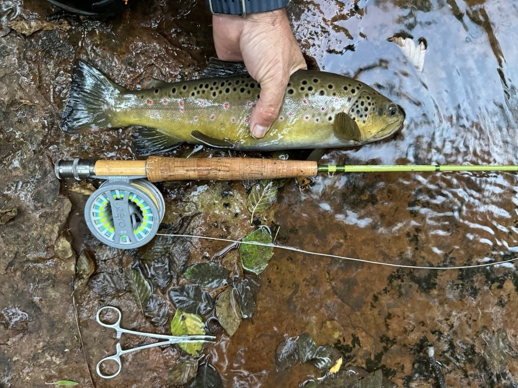
Redington Path Fly Rod Combo Kit with Pre-Spooled Crosswater Reel, Medium-Fast Action Rod. 5 wt 9 ft. Buy on Amazon | Buy at Bass Pro Shop
Orvis Clearwater Fly Rod Outfit - 5,6,8 Weight Fly Fishing Rod and Reel Combo Starter Kit with Large Arbor Reel and Case. Buy on Amazon | Buy at Bass Pro Shop
Clothing:
Pants: Orvis Jackson Quick-Dry Pant | Kuhl Renegade Rock Pant
Shirts: Arc'teryx Cormac Hoodie | Patagonia Capilene Cool Daily Hoodie | Free Fly Men's Bamboo Lightweight Hoodie
Footwear: Chaco Z/2 Classic Sandals | Simms Flyweight Access Wading Boots | Simms Flyweight Neoprene Wet-Wading Socks
Packs and Bags:
Backpack: Gregory Zulu 65 | Gregory Alpaca Duffel 45
Fishing Pack: Orvis Sling Pack | Orvis Chest/Hip Pack
Accessories:
Umpqua River Grip Zing/Nipper/Hemo | Yellowstone Fly Goods Fly Agra Floatant | Orvis Superstrong Plus Tippet | Orvis Leaders | Nomadix Bandana Towel | Nomadix Poncho Towel |
Salt River Fishing Report - June 26, 2023
Fishing report for the lower salt river on June 26 2023
Salt River, Mesa, AZ - Blue Point recreation area, June 26, 2023
Pretty solid day for trout fishing just upstream of the bridge. We arrived at 6 AM and had a fish on the line on my first cast. We fished until about 10 AM and caught seven fish between the two of us. I mainly stayed near the overhead line And floated the current downstream. I was using various types of power bait dough on a sliding sinker rig with a barbless treble hook. I caught six out of the seven of those fish. The trout ranged in size from 8 to 14 inches. All of them were beautiful rainbows most likely all stocked My friend tried multiple different rigs, mostly using a drop shot variation, but didn’t have as much luck. We believe his weight was too heavy and he kept getting gnarled up in the grass beds.
As expected around nine 9:30 AM the float traffic started to pick up and the fish started to slow down. We did mess around with my fly rod but didn’t see any action on it. We couldn’t do much casting because of how much the float traffic was flowing.
Water temp: 56 | Air temp: 89-95

The Gear I used:
- Rod: Okuma Celilo Graphite Lightweight Ultra Light Freshwater Rods, CE-S-662ULb (link)
- Reel: Okuma C-30-CL Ceymar Spinning Reel (link)
- Line: SpiderWire Stealth Braid Fishing Line Hi-Viz 20lb (link) | Seaguar Tatsu 6lb leader (link) | Barrel Swivel size 12 (link) | Treble Hooks Size 10 (link)
- Bait: Berkley Powerbait - Corn (link) | Berkley Powerbait - Garlic (link)
- Clothing: Free Fly Men's Bamboo Lightweight Hoodie (link) | Free Fly Men's Breeze Pant (link) | Chaco Mens Z/1 Classic (link)
- Other Gear: KastKing BlowBak Tactical Fishing Sling Tackle Storage Bag (link) |

About the Salt River
Nestled amidst breathtaking landscapes, the Salt River offers an abundance of trout and an opportunity to hone your angling skills. In this article, we'll delve into the ins and outs of Salt River trout fishing, covering the best locations, essential techniques, and valuable tips to help you reel in the big ones.
- Exploring the Salt River:
The Salt River, known for its stunning beauty and crystal-clear waters, is a haven for trout. It meanders through serene valleys, gorges, and canyons, creating an idyllic backdrop for fishing enthusiasts. From the upper reaches to the lower stretches, the river presents various fishing opportunities, making it an appealing destination for anglers of all skill levels. - Prime Fishing Spots:
While the Salt River offers abundant fishing spots, a few locations stand out for their trout population and angler-friendly conditions. Cast your line at the scenic Sycamore Creek or try your luck at the Lower Salt River, known for its trophy-sized rainbow trout. Other promising areas include the Salt River Canyon, where you can enjoy fishing while surrounded by stunning canyon walls. - Techniques for Success:
Successful trout fishing in the Salt River demands a combination of skill and strategy. Consider using lightweight fishing gear, such as a 4-6 weight rod, to maintain finesse and precision. Match your flies to the prevalent insect hatches, as trout in this river are known for their selective feeding habits. Popular fly patterns include Adams, Elk Hair Caddis, and Blue-Winged Olives. Remember to perfect your presentation and drift techniques to entice these wily fish. - Valuable Tips for Anglers:
a. Time your fishing trips: Early mornings and late evenings often yield the best results as trout are more active during these periods.
b. Practice catch and release: Help preserve the trout population by practicing responsible fishing. Return your catch to the river, ensuring its continued growth and sustainability.
c. Pack essential gear: Don't forget to bring waders, polarized sunglasses, sunscreen, and insect repellent to make your fishing excursion comfortable and enjoyable.
Conclusion:
For passionate anglers seeking a memorable fishing experience, the Salt River is a treasure trove of trout fishing opportunities. Its scenic beauty, coupled with an abundance of trout, makes it a must-visit destination. Armed with the right techniques and tips, you can maximize your chances of landing that prized catch. So, pack your gear, head to the Salt River, and embark on an angling adventure that will leave you with unforgettable memories. Keep checking back here for updated fishing reports around the valley.
Nemo Dragonfly Osmo 2P Bikepack Tent - Lightweight & Durable
The Nemo Dragonfly Osmo 2P tent is light and durable, with excellent ventilation and waterproof protection - perfect for bikepacking.
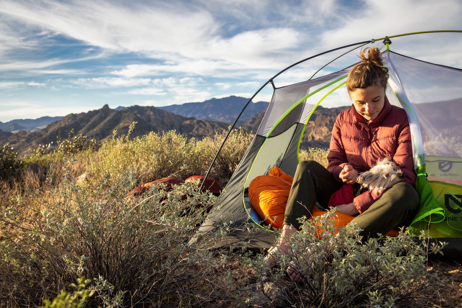
The Nemo Dragonfly Osmo 2P Bikepack Tent is an awesome option for those gnarly souls getting into bikepacking. But, let me just throw this out there - this tent is also an excellent choice for backpackers. I will get into the details more as we go. It is lightweight, weighing in at 4.1 pounds, made with durable, high-quality materials and loaded with weatherproof features to ensure comfort on the trails.
Features of the Nemo Dragonfly Osmo 2P Bikepack Tent:
(Almost) Ultralight: With a trail weight of 4.1 pounds, the tent is lightweight, making it light enough to carry along on bikepacking and backpacking trips, but I wouldn't consider that to be ultralight. Especially if you pin it up against the Hornet 2P. (More on that later)
Spacious Interior: Ample space is available to fit two people, as well as additional gear storage. Especially if you take advantage of the vestibule areas, clever pocket designs and use the gear tray.
Simple Setup: With color-coded poles and grommets, the tent can be assembled with ease even in low-light conditions.
Durability: Crafted with 15D ripstop nylon and floor fabric, it is sure to remain secure against wear and tear as well as any potential damage from weather conditions. If you plan on camping in wet weather or on rougher terrain (read: the desert), you should definitely pick up the footprint.
Ventilation: For comfortable temperatures in warmer weather, it has large doors and mesh panels to guarantee great ventilation. The Dragongfly tent body uses a white mesh for privacy around the sides, and black mesh to make sure you can see the night star up above.
Bikepacker-Friendly: Its compact design fits easily in a pannier or bikepacking bag, perfect for the avid cyclist. There are built-in straps on the carrying bag giving options for varying ways of mounting it to your bike.
Accessories: The Nightlight Pocket allows your headlamp to illuminate the inside of your tent, diminishing the presence of blue light to create a soft and consistent ambiance. Equip your vestibule with Landing Zone's waterproof, removable storage tub for extra protection of your gear from dirt and moisture.
Sustainable: This tent is created with recycled materials, making it an eco-friendly choice for outdoor enthusiasts. Win for Mother Earth!
Specifications of the Nemo Dragonfly Osmo 2P Bikepack Tent:
The Nemo Dragonfly Osmo 2P Bikepack Tent is an awesome choice for bikepackers in search of a lightweight, long-lasting tent that is able to endure any kind of weather. It is designed to be set up quickly and its sustainable materials make it a sensible choice for individuals seeking to make minimal environmental impact while enjoying the great outdoors. It's loaded with features, super easy to set up, has some special design features for mounting to a bike, a low profile colorway and a viable option for backpackers as well!
View through the door of Nemo Dragonfly Bikepack Osmo 2P
How Does it Stack up Against the Nemo Hornet 2P
If you've been following along on this site, you know that I am a huge fan of the Hornet 2P. I have used that tent more than any other tent I have ever owned, in many different weather conditions and climates. It's the jam. I will be honest, the first time I set up the Osmo, I knew that this was likely going to replace my Hornet. Why? It's completely freestanding which is something that I love, especially living in the desert where oftentimes the ground is incredibly hard.
The 2 tents are very similar in size and shape, but the Osmo is built to be a bit more durable and easier to setup, breakdown, and carry. However, it comes at the price of weight - not much, but noticeably heavier. So, if you are a stickler for keeping those grams down, the Hornet would be better suited for you.
I built this comparison table so it’s easy to see the differences side by side. I put the spec in BOLD when it is the winner. It’s a pretty tight battle, so choosing which tent works best for each person is going to be a personal preference.
Discovering the Beauty and Adventure of Pinnacle Peak Park
Pinnacle Peak Park is a breathtaking natural park located in Scottsdale, Arizona. It offers scenic views of the surrounding desert landscape and the Sonoran Desert, making it a popular destination for outdoor enthusiasts and tourists alike. The park covers over 1,200 acres of land and features a variety of hiking trails, picnic areas, and scenic vistas.
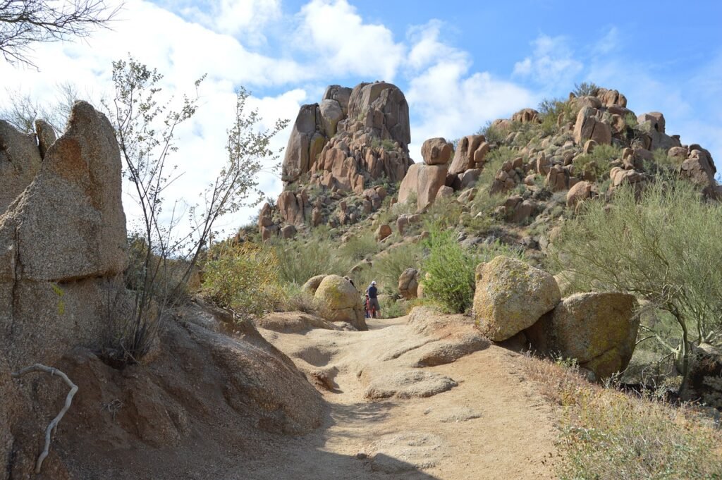
One of the most popular features of Pinnacle Peak Park is its challenging hike to the summit. The Pinnacle Peak Trail is a 2.75-mile round-trip hike that takes visitors to the top of the park's iconic peak. The trail is steep and rocky, but the views from the top are truly breathtaking. On a clear day, visitors can see for miles in every direction, including the city of Scottsdale and the McDowell Mountains. The summit is also a great spot for wildlife viewing, as a variety of animals, including coyotes, snakes, and lizards, call the park home.
In addition to hiking, Pinnacle Peak Park also offers a variety of other outdoor activities. The park is a popular destination for picnics, with several picnic areas available for visitors to use. The park also has several nature trails, including the Nature Trail and the Cactus Trail, which offer a closer look at the park's unique flora and fauna.
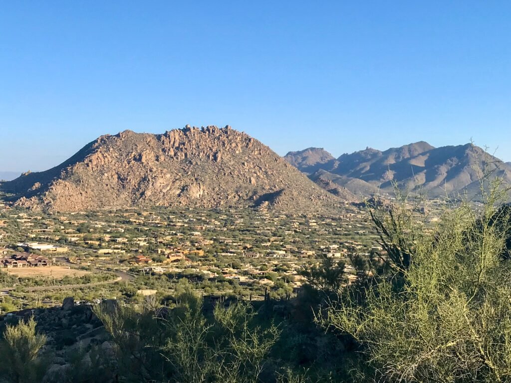
One of the most unique features of Pinnacle Peak Park is its geology. The park is home to a variety of rock formations, including large boulders and unusual rock formations. The park's geology is a result of millions of years of erosion and tectonic activity, and it provides a fascinating look into the history of the Earth. Visitors can also learn more about the park's geology by visiting the Pinnacle Peak Visitor Center, which offers educational exhibits and programs.

In conclusion, Pinnacle Peak Park is a must-visit destination for anyone looking to experience the beauty and serenity of the Sonoran Desert. Whether you're a hiker, a nature lover, or just looking for a relaxing day in the great outdoors, Pinnacle Peak Park has something to offer. With its stunning views, challenging hikes, and unique geology, the park is a true gem in the heart of Scottsdale, Arizona.
In Town for the Super Bowl LVII in Phoenix?
Phoenix, Arizona is a popular destination for tourists during the Super Bowl, and for good reason. The city is known for its warm weather and vibrant culture, making it a great place to visit during the big game. In addition to the Super Bowl festivities, there are plenty of other attractions and activities to keep visitors entertained.
If you're in town for the Super Bowl and looking for a break from the excitement, consider visiting Pinnacle Peak Park. The park is just a short drive from the city and offers a serene escape from the hustle and bustle. Take a hike to the summit of Pinnacle Peak and enjoy breathtaking views of the surrounding desert landscape, or simply relax and enjoy a picnic with friends and family. Whatever your interests, Pinnacle Peak Park is a must-visit destination for anyone visiting Phoenix during the Super Bowl.
Other Hikes to check out Nearby
5 Adventures in Phoenix during the Winter
Spending winter in Phoenix, Arizona is a great experience with its warm climate and wide range of outdoor activities to do.
Here are five amazing adventures to take in Phoenix during the winter:
Hiking - Take advantage of the moderate winter temperatures and explore some of the best trails in the area. Hike through McDowell Mountain Regional Park or along the shoreline of Tempe Town Lake for beautiful views and breathtaking nature.
Horseback Riding - Hop on horseback for an unforgettable ride across one of the nearby desert trails, with stunning views all around you. Spend an afternoon exploring South Mountain Park or embark on a sunrise ride around the Apache Trail Monument Valley.
Rock Climbing - Challenge yourself to some rock climbing at Papago Park’s Sandstone Quarry or Black Canyon National Park and feel like you’re soaring high above the valley floor!
Golfing - Get some practice in before spring golf season by hitting up one of Phoenix’s premier golf courses like Encanto 18, where you can challenge your skills and work on perfecting your game!
Off-Roading - Explore Phoenix's desert terrain on a guided ATV tour! Experience sand dunes, winding trails, and stunning red rock formations all while having a wild time!
Bulletproof Coffee
Want a cup of coffee that will sustain your energy throughout the morning and for all your adventures? Then make it bulletproof.
After traveling to Tibet and trying yak butter tea biohacker Dave Asprey brought home the recipe and coined it “Bulletproof coffee.” So what is it exactly? It's a combination of clean caffeine from coffee beans mixed with healthy fats from unsalted butter and MCT oil. The combination provides a sustained energy throughout the day. No more caffeine crashes!

The Bulletproof Coffee Recipe
- 1 cup of coffee
- 1 tsp - 2 Tbsp MCT OIL (work your way up with this one as you can initially get stomach cramps)
- 1-2 Tbsp unsalted grass fed butter
- For a hint of spice add a sprinkle of cinnamon!
It’s best to blend the three ingredients together in a blender otherwise the oils and fats separate. Blending makes for a very smooth creamy latte.
- Calories: 230
- Fat: 25g
- Saturated Fat: 21g
- Carbs: 0g
- Protein: 0g
- Fiber: 0g
- Sugar: 0g
- Salt: 0mg

So why does it provide sustained energy? Let's break the ingredients down.
THE BULLETPROOF COFFEE
Coffee is a powerful antioxidant. Caffeine keeps you alert and boosts your metabolism. But just like the food you eat, the quality of the coffee you drink matters. Bad quality coffee can make you feel tired and sluggish, reaching for another cup. While a clean quality bean can keep you fueled and energized.
Avoid coffees with molds like ochratoxin. Molds will steal your mental edge and make you weak. For sustained energy it’s best to choose organic coffees that test for molds and toxins like Bulletproof.
We love Bulletproof not only because it’s a clean bean coffee but because they also support sustainability and our environment.
GRASS FED BUTTER
Unsalted grass fed butters are a nutrient dense source of fat providing fuel for energy. We like unsalted Kerrygold.
MCT OIL
A fat burning fuel made from coconuts. This is the key ingredient that helps you feel energized and focused. MCT's don't have to be broken down in the body therefore they give your cells an immediate energy source to pull from.
Keto
If you are interested in learning more about keto and a toxin free lifestyle check out Keto Canary.
Don't forget to save the recipe on Pinterest!


How to Hike to Cathedral Rock in Sedona, Arizona
So you're thinking of visiting Sedona? You're about to go on an incredible journey. The red pillars are among the most spectacular sights I've seen while hiking. It's one of the most beautiful spots I've ever seen. One of the best things to do in Sedona is hike Cathedral Rock which is why it made our Top 6 Hikes in Sedona.
Sedona is a place where you simply must go outside. Cathedral Rock Trail is one of my favorite Sedona hikes due to it's challenges.
Everything you need to know about climbing Cathedral Rock in Sedona is right here!

WHEN IS THE BEST TIME TO HIKE THE CATHEDRAL ROCK TRAIL?
The greatest time to hike Cathedral Rock Trail is without a doubt in the hours leading up to dusk. There are great views of Sedona from the top, and it is even more magical at sunset.

If you plan on lingering at the summit until sunset, carry a headlamp to assist you in descending the trail. You'll need your hands to get down the trail's steeper sections.
The best time of year to hike cathedral rock is fall to early spring for cooler temps and less crowds.
HOW TO GET TO THE CATHEDRAL ROCK TRAILHEAD IN SEDONA
Cathedral Rock is one of the most popular Sedona hikes. There are multiple trailheads that lead to Cathedral Rock but we found Cathedral Rock Trailhead No. 170 to be the closest.
Cathedral Rock Trail Head Coordinates: 34°49’30.7″N 111°47’18.3″W
The parking lot is a lot busier during the more popular hiking times. Typically, the earlier you are there, the easier parking will be.
There is overflow parking further down on Back O’Beyond Road.
DIRECTIONS TO THE CATHEDRAL ROCK TRAILHEAD
Head south on the junction of 89A and 179. Drive 179 south for about 3.5 miles until you reach Back O’ Beyond Road on the right. Then go approximately .6 miles. The parking lot turnout is on the left.
Note: There is a $5 cost for the Red Rock Pass for parking. The America the Beautiful Pass is also a valid parking pass.
CATHEDRAL ROCK VIA THE BALDWIN TRAILHEAD
There is an alternate way to get to Cathedral Rock if you want a longer and more scenic hike. It starts from the Baldwin Trailhead. The trail is 3.7 miles round trip, and it takes about 1.5 hours to get to the top of Cathedral Rock.
This route will have wonderful views of the west side of Cathedral Rock as you start your hike.
CATHEDRAL ROCK HIKE

HOW LONG DOES IT TAKE TO HIKE CATHEDRAL ROCK IN SEDONA?
Cathedral Rock in Sedona will take 30-40 minutes if you hike at a moderate to fast pace. It will take roughly 60 minutes to hike to the top if you hike slower, if you are hiking with children, if you take some breaks along the route, or if you stop to take photos.
I would recommend planning for about 3-4 hours for the entire adventure.
TRAIL STATS –
- Length: 1.2 miles
- Elevation Gain: 744 feet
- Route Type: Out & Back
- Difficulty: Moderate
CLIMBING CATHEDRAL ROCK IN SEDONA
In general, the Cathedral Rock route is simple to follow. Along the trail, there are basket cairns packed with rocks to direct you. The trail begins with a dried-up creek, followed by a short ascent to a plateau.
The plateau region offers stunning views over the Sedona area and is an excellent location for photographing Cathedral Rock in the background.
You'll climb up through the scramble from there. It's a little crag that you'll have to climb on your hands and knees to get to. This is the most difficult section of the hike, but if you go slow and steady, you'll be OK. The crack is about 40 feet long and has a 45-degree incline.
After the scramble, you'll come to another plateau, which is an excellent area to pause and snap photos if you want to. You'll continue climbing Cathedral Rock from there. There are few stone steps at the summit that will lead you to the top.
The end of the trail has a sign saying, “End of Trail”, but the views alone will tell you that you are there!
HOW DIFFICULT IS THE CATHEDRAL ROCK HIKE?
Although the hike to the summit of Cathedral Rock is short, it does include some steep sections. The Cathedral Rock Trail has certain sections where you must scramble over the rocks using your hands and feet.
For most people, it is not too much of a challenge to climb over the boulders, but this could be difficult depending on the physical abilities of those you are hiking with. The trail is well broken in with places for hand and footholds in the rock making the climb a little easier. Make sure you are wearing sturdy shoes or even better ---> CHACOS!!!
AT THE TOP

At the summit, there is a ledge that wraps around the top making a lot of places to explore and room for everyone. There is a very large drop-off at the top, but the ledge is pretty wide to have safe places for kids to sit.
The highlight and favorite viewpoint is off to the far right after you have reached the summit viewing area. There is a fun ledge that is a great place to take pictures and enjoy the views. It is known by some as the Edge of the World. There is a high and steep drop-off here so be careful.

HEADING DOWN THE TRAIL
There are some spots you will need to slide down on the rocks, but overall, the hike down is pretty easy going and simple to follow - just keep an eye out for the baslets of rocks that you passed by on the way up.
As you head down Cathedral Rock be sure to notice the beautiful views in the distance. Courthouse Butte will be visible as well as Sedona.

SEDONA GUIDED TOURS
Sedona is a lovely destination with plenty of options for independent exploration. However, with so many energy vortexes and gorgeous sites to visit, it can be tough to determine where to spend your time and easy to overlook many of Sedona's unique attractions.
If you want the best Sedona tour with a lot of flexibility, I suggest booking a guided tour with Sedona Spirit Journeys.
During this highly recommended tour, an experienced guide will teach about the area’s sacred nature and energy vortexes as well as the history and geology of the area. This is a great way to see everything Sedona has to offer.
The best part of it all? You pick your stops and then sit back and relax!
HIKING TIPS FOR CATHEDRAL ROCK IN SEDONA
- PLAN TO HIKE EARLY IN THE MORNING OR AT SUNSET - These two times of day will give you the best lighting and will help you beat the crowds.
- CHECK WHAT TIME SUNSET IS - Check to see what time sunset is expected for that day if you want to be there for sunset. To reach to the summit, you'll want to give yourself plenty of time. Depending on how quickly you hike, it normally takes 30-60 minutes.
- If you are planning on staying at the top of Cathedral Rock until sunset, make sure to bring some sort of flashlight to get down. Headlamps are the best so you can have your hands-free climbing down the rock.
- USE YOUR AMERICAN THE BEAUTIFUL ANNUAL PASS - The American the Beautiful Pass is honored for the daily pass for parking for all the Sedona trails. If you do not have a pass, you can purchase a pass for $5.00 at the fee machines at designated trailheads.
- BE PREPARED - This includes sunscreen, plenty of water, and snacks. Don’t be fooled into thinking the hike is only a mile. The pathway is steep and narrow in places making it more difficult. There is also little to no shade on the trail.

CAN YOU SEE CATHEDRAL ROCK IN SEDONA WITHOUT HIKING?
Whether you can see Cathedral Rock without hiking depends on what you are wanting to see. You can see the Cathedral Rock formation from below. Hikers will not be able to see the panoramic valley views or cradle of Cathedral Rock. You can only get to those by hiking to the top.
If you want to see Cathedral Rock from a distance, the Templeton Trail is a good alternative. Also, you can climb to the first plateau for a great picture area without making the steep ascent through the crack.
IS CATHEDRAL ROCK TRAIL DOG FRIENDLY?
Cathedral Rock is dog-friendly if the dogs are kept on a leash. There are some big steps and boulders to climb through, so it is recommended that your dog have hiking experience. In my opinion, once you get to the rock-climbing portion it really is not an ideal hike for dogs unless your dog has a high level of physical abilities.
LET'S TALK ABOUT THE VORTEX
Sedona is a lovely destination to visit where you can easily connect with nature. Some visitors travel to Sedona in search of powerful vortex encounters. Cathedral Rock is said to be one of Sedona's four vortexes.
This vortex energy is one of many reasons why people hike the Cathedral Rock Trail. This energy is meant to calm, inspire and ground you.
No matter what your beliefs, Cathedral Rock is a place that will make you feel something. Whether it is outer-worldly spirits or awe and appreciation for the beautiful world we live in, a climb to the top is well worth your time.
OTHER HIKING TRAILS IN SEDONA
Hiking Cathedral Rock in Sedona is my favorite trails in the area but there is still plenty of other fun and beautiful hikes to explore in the area. We recommend picking a hike or two every day because it is such a beautiful area to enjoy.
BIRTHING CAVE
- Hiking the Birthing Cave in Sedona is another family-friendly hike that we enjoyed. The trail is pretty flat until the final descent into the cave. The cave is a fun place to play and has beautiful views of the Sedona area. Be sure to download the coordinates of the cave before heading out before cell coverage is limited.
BELL ROCK TRAIL
- This is a fun area to explore, especially if you’re hiking with kids in Sedona. The Bell Rock Loop is about a mile long with lots of fun places to explore along the way. You can climb all over Bell Rock with great views of the Sedona area.
DEVILS BRIDGE
- The Devils Bridge hike is another great and popular photo opportunity in Sedona. It is a natural sandstone bridge with great views of Sedona. The trailhead is easy to access with an easy hiking trail. The only downside is the trail is about 4.2 miles roundtrip.
SOLDIERS PASS
- This is a relatively easy trail until the final descent into the cave. It is a heavily trafficked trail with plenty to see along the way like the Seven Sacred Pools and sinkhole. This is a popular hike for families.
MORE TO SEE!
Also, don’t forget that Sedona is only a two-hour drive to the Grand Canyon. You could easily add this in as a day trip during your time in Sedona! Visiting the Grand Canyon is a must-see in Arizona!
If you are going to be exploring the area around Sedona, Page is a fun city to visit. The Horseshoe Bend overlook and Antelope Canyon are fun places to explore.
How to Visit Horseshoe Bend in Arizona
Lower Antelope Canyon – Visiting the Famous Slot Canyon
Pin for Later –

WANT MORE ARIZONA INSPIRATION? FOLLOW OUR VISIT ARIZONA BOARD ON PINTEREST!
The 6 Best Hikes in Sedona You Need to Do
Here is a list of the Top 6 hikes in Sedona. Beautiful hikes can be found all throughout Sedona.
On my list of the top 6 hikes in Sedona, you'll find everything from a simple walking route to a heart-pumping hike up a mountain.
Check out this Web Story!
Top 6 Hikes in Sedona
Let's Get Into it

Cathedral Rock Hike (SEE TRAIL GUIDE HERE)
One of the best hikes in Sedona is Cathedral Rock. This hike is short and quick, and it's a lot of fun from start to end, with some rock scrambling and jaw-dropping views.
Expect no solitude on this trail due to its popularity. The hike to Cathedral rock and the reward of panoramic vistas are the highlights of this adventure.
On a much greater scale, it's very similar to the bell rock climb. You'll hike and scramble your way up to Cathedral rock from the trailhead until you reach the saddle between the sandstone massive spires.
Pro Tip: This is one of the most popular hikes in Sedona and getting a parking space can be a real challenge, so get there early.

Devils Bridge
In Sedona, this is a very popular hike. Hundreds of people hike to the bridge every day to take photos of the vistas and even propose.
Devils Bridge is only a 2-mile round-trip hike from the trailhead. It's largely level and fast, with a few series of inclines and stone steps right before reaching the bridge.
Getting to the trailhead is the tricky part. The Devils Bridge Trailhead is located on a dirt road that requires a high clearance vehicle to access. If you don't have a 4x4, you'll have to walk down Dry Creek Road from the Mezcal Trailhead.
Devils Bridge is the largest natural sandstone arch located in the Sedona area of Coconino National Forest.

Broken Arrow
The Broken Arrow Trail is one of the busiest short hikes in the area, because to its convenient location on the south side of Sedona, just off Highway 179, and its proximity to a popular jeep track.
Both routes rise gently up a large valley with colorful, jagged, eroded red cliffs and buttes on both sides, terminating at a low pass (Chicken Point) with good views south to Oak Creek Canyon and north to Sedona and the high mountains beyond.
The standard $5 Red Rock Pass is required for all parked vehicles.
Bell Rock
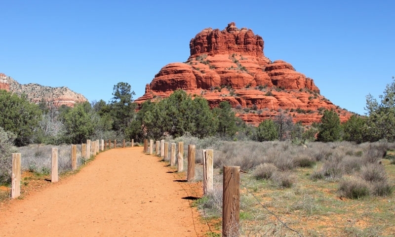
One of Sedona's most well-known features is Bell Rock. Hiking up to Bell Rock is a lot of fun, which is why it's one of Sedona's most popular climbs.
The ascent begins with trail signs and wire baskets filled with boulders for the first.25 miles. The wire baskets vanish as you go further up Bell Rock, but you can continue hiking higher by figuring out your own route.
Rock scrambling up to the top levels of bell rock is part of the fun of this hike. It's entirely up to you how far you want to go. You won't be able to climb all the way to the summit of the rock, but you can get quite close.
It is quite clear how it received its name; it looks like a giant red bell melting into the landscape.

Soldiers Pass
There are a number of reasons why the Soldier Pass Trails is one of Sedona's top hikes. For one thing, it's a short and simple hike. But it also passes along some rad features like the seven sacred pools, the Devil's Kitchen Sinkhole, and if you can find it, the famous Soldier Pass Cave.
West Fork Trail
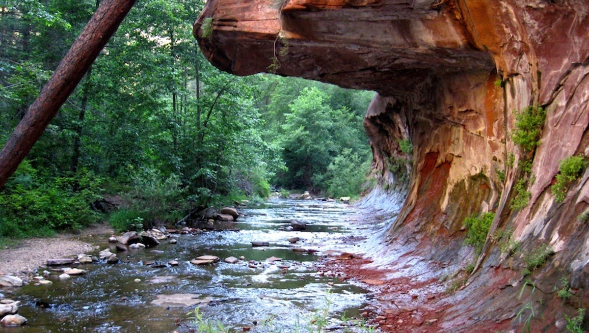
The super-easy and insanely picturesque hike follows Oak Creek. Because of its shady route and tranquility, this hike in Sedona is unlike any other in the area.
You stroll along the creek for virtually the entire hike and get to see how the creek chiseled away the canyon walls. It resembles the subway in Zion National Park in a lot of ways.
This is a nice hike to do on a hot day in Sedona because you're in the shade of the trees.
What to Bring on your Top 6 Hikes in Sedona Adventures
- Footwear – Chacos
- Hydration – Camelback Hydration Backpack (Bring lots of water!)
- Camera – Canon EOS R
- UV - Sunglasses / Hat / Sunscreen
Share these Top 6 hikes in Sedona on Pinterest


Echo Canyon Trail on Camelback Mountain - What You Need to Know
Echo Canyon Trail on Camelback Mountain is one of the most popular hikes to do around Scottsdale and Phoenix, AZ. Here's Why!
Hike Echo Canyon Trail - Camelback Mountain
Camelback Mountain via Echo Canyon Trail is a 2.5 mile heavily trafficked out and back trail located near Scottsdale, Arizona that offers scenic views and is rated as difficult.
Getting There:
The parking lot is off Squaw Peak drive and leads to many more hiking trails in the Phoenix Mountain Preserve. The route starts on a short connector trail and then goes straight up to the summit.
The Trail:
The trail begins from the top of the parking lot, just beyond the restrooms and benches. An easy incline at first, the path passes a smaller rock formation, then approaches the base of a larger one known as the “Praying Monk”. If you look up from the Echo Canyon trail, you may see roped-up rock climbers scaling the face above you. And if you turn around and look the other way, you can see Piestewa Peak rising up behind you.
At around 0.4 miles the trail picks up with a set of wooden stairs. Soon after this, the route becomes so steep that there are metal railings anchored into the mountain to safely assist hikers in this potentially dicey situation.
At first, a metal pole will only be on your left-hand side but soon after there will be a pole in the middle and then to the right. From my experience, the pole on your left (as you are going up) is the best pole to hang onto. There are carved out foot notches in the rock that will help your feet up. The other poles will not have these little notches, so it feels a little uncertain to walk on since it’s so steep and smooth you can easily slide on it, even with good gripping shoes.
Once at the top of this steep section, you might think the tough part is over — but it’s only just begun! The trail now will require scrambling pretty much up all the way to the top. For this reason, you might want to consider bringing gloves along, although it isn’t completely necessary.
There are steep piles of bigger rocks that you will need to hike up. At times, it feels as if you’re back in that aquarium climbing up big pieces of gravel to get the relief of freedom up at the top. There is a small dip just before the one mile mark, then the trail rises steady and even steeper as it nears the summit. It’s easy to get a little off track in the last section – just keep looking for the path of least resistance.
The trail makes one final bend to the left as it leads you to the top! Take in the awesome 360-degree view of the valley, with Piestewa close by to the northwest. But make sure you pay attention to which way you came up – it’s easy to mistakenly go down the wrong trail. When you are done soaking in the views, return down the way you came up.
Echo Canyon Trail Map:
Nearby Adventures
Hike Pinnacle Peak
Mountain Bike Pemberton Trail
SHARE THESE TOP 5 HIKES IN PHOENIX ON PINTEREST
Camelback Mountain Hiking Resources
Overview of the Camelback Mountain Trails from Phoenix Parks and Recreation. Best resource for the latest information on closures, maintenance and other official notices.
Please #RecreateResponsibly and Leave No Trace
The 5 Best Hikes In and Around Phoenix
Here is a list of the best 5 hikes in and around Phoenix. Everything from a simple walking route to a heart-pumping hike up a mountain.
Here is my list of the Top 5 hikes in Phoenix. Beautiful hikes can be found all throughout Phoenix. You don't even have to leave the city boundaries!
Within a short drive of the Greater Phoenix area, there is a terrific trail for every skill level.
On my list of the top 5 hikes in Phoenix, you'll find everything from a simple walking route to a heart-pumping hike up a mountain.
Check out this Quick Web Story!
Top 5 Hikes in Phoenix - Let's Get Into it
Echo Canyon Summit
Echo Canyon Summit
Echo Canyon - Camelback Mountain
This short yet picturesque hike in Scottsdale is the most well-known and popular hike in the Phoenix area.
This trail is an intense and difficult anaerobic hike the entire 1.23 miles to the summit. It ascends approximately 1,280 ft, from 1,424 ft above sea level to 2,704 ft.
Bring lots of water, and if you're not a seasoned hiker, enlist the help of a local guide or a buddy to show you the ropes. The trek will take around 2 to 3 hours round trip.
Only experienced hikers or those in the company of someone who understands what to anticipate should undertake this trip. It's steep, with portions where you'll have to rely on your hands and feet. On the harder/steeper sections, there are handrails. These help many hikers but also add points of congestion.
The initial part of the trek is a moderate ascent to a saddle. The next section is a hard ascent up rocks that follows a wall up a series of stairs. To aid hikers, a handrail runs along the length of this stretch.
The Echo Trail is regarded as extremely tough. This hike has the highest number of rescues and deaths per year of any hike in a major urban region in the United States.
Top 5 Hikes in Phoenix - Piestewa Peak
Summit Trail - Piestewa Peak
Piestewa Peak Park has a variety of trails that range from simple to brutal. Serious hikers go for the Summit Trail. It is considered the cousin to Echo Canyon on Camelback, though they have a very different "feel" to the trail and, obviously, views.
Piestewa Peak is nearly in the heart of Phoenix, and it can be viewed from almost anywhere in the city. As a result, the path to the top is quite popular, so expect large crowds of walkers, hikers, and trail runners.
You'll be rewarded with views of Camelback, the Superstitions, the White Tanks Mountains, and the red slopes of Papago Park.
The route is well-designed, with handrails in certain places to assist with the numerous stairwells. On the way back, you should expect a sequence of knee-jarring steps down.
Parking for the trails is limited. Arrive early in the day. At the trailhead, there are restrooms and drinking fountains.
Top 5 Hikes in Phoenix - Siphon Draw to Flatiron
Siphon Draw Trail - Superstition Mountains
The Flatiron Summit via Siphon Draw is recommended for experienced hikers in good physical condition who want a challenge.
If you're thinking about taking on this hike, keep in mind that it's a 6.2-mile round-trip adventure with nearly 3,000-foot elevation gain, and much of it is in direct sunlight. The roundtrip usually takes 4-6 hours.
At the summit, you'll be rewarded with breathtaking 360-degree vistas and a profound sense of accomplishment.
White and blue dots indicate the main trail. The path is rough in places, with gravel, and some boulder climbing is necessary.
Lost Dutchman State Park is home to the Flat Iron Summit Trail. There is a daily charge to park here. Camping in the park is a practical alternative if you want to get an early start on this adventure.
Pinnacle Peak - McDowell Mountains
This hike is one of Scottsdale's most popular and busiest. It is filled with beautiful surroundings and relative simplicity. No list of the Top 5 hikes in Phoenix could exist without it!
A slow rise up a boulder-covered ridge studded with Sonoran Desert vegetation, marked by tiny signposts, leads to a breathtaking perspective of the surrounding region. Tom's Thumb, Troon North Golf Club, and the Four Seasons Resort can be seen from the summit.
This is a 3.5-mile out-and-back trek with a 1,300-foot elevation gain. This path attracts a diverse range of hikers, from fully equipped trail runners to those out for a stroll in their flip flops, and even some pausing to practice yoga postures along the way. Depending on the season, you may see some rock climbers attempting to reach the summit.
This trek has almost no shade. It is best to start early in the day to avoid the heat and congestion.
A fully-staffed tourist center with washrooms and information is located at the base.
Top 5 Hikes in Phoenix - Tom's Thumb Trail in the McDowell Mountains
Tom's Thumb Trail - McDowell Mountains
The Tom's Thumb Trailhead is used by a wide range of people as a starting point for their adventures. Explorers enjoy the aerobic exercise that comes with climbing over 1,300 feet in just 2.4 miles (each way). They're rewarded with panoramic city views at the summit, which give them well-deserved bragging rights for months.
This route is 4.9 miles long and has an elevation gain of around 1,374 feet.
Set out early in the morning to beat the heat. A facility with bathrooms, a big covered outdoor space, and information is located at the trailhead.
What to Bring on your Top 5 Hikes in Phoenix Adventures
Footwear – Chacos
Hydration – Camelback Hydration Backpack (Bring lots of water!)
Camera – Canon EOS R
UV - Sunglasses / Hat / Sunscreen (there is no shade on this entire trail for the majority of the day)
NEARBY ADVENTURES
Hike Pinnacle Peak
Mountain Bike Pemberton Trail
Share these Top 5 hikes in Phoenix on Pinterest
OUTDOOR
ADVENTURE
Featured Posts
HIKING
|
FLY FISHING
|
CAMPING
|
BACKPACKING
|
GEAR REVIEWS
|
HIKING | FLY FISHING | CAMPING | BACKPACKING | GEAR REVIEWS |
Best of
Top Clothing Brands of 2023
Discover unbeatable deals on Patagonia winter essentials at the REI Outlet sale! Get up to 40% off on jackets, parkas, and more.
Subscribe to Our Newsletter
Sign up with your email address to receive news and updates.
Get in touch.
Just like in a hardcore round of intense pickleball, communication is key! Reach out with any questions, comments, beer recommendations, inquiries, critiques and jokes.





A well-equipped car camping kitchen setup makes outdoor cooking effortless. Here’s my essential gear list—powered coolers, Jetboil stoves, storage solutions, and more—to help you cook like a pro on the road.